Work with Cesium

Cesium is integrated into MindDev and enables the visualisation of large-scale real environments
Integration of Cesium with MindDev
Version 2025 of MindDev is required to access data from Cesium.
Cesium documentation
Cesium documentation is available at this address: https://cesium.com/learn/unity/unity-quickstart/#step-2-connect-to-cesium-ion
Cesium integration
Using Cesium requires the creation of a Cesium ION account (https://cesium.com/platform/cesium-ion/). A user account gives access to the necessary access token.
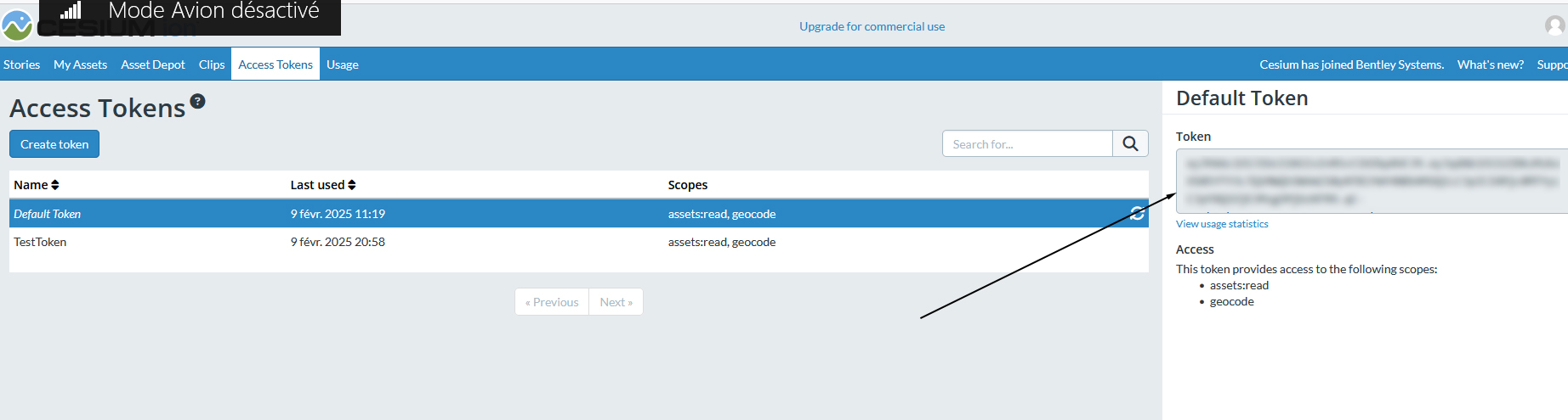
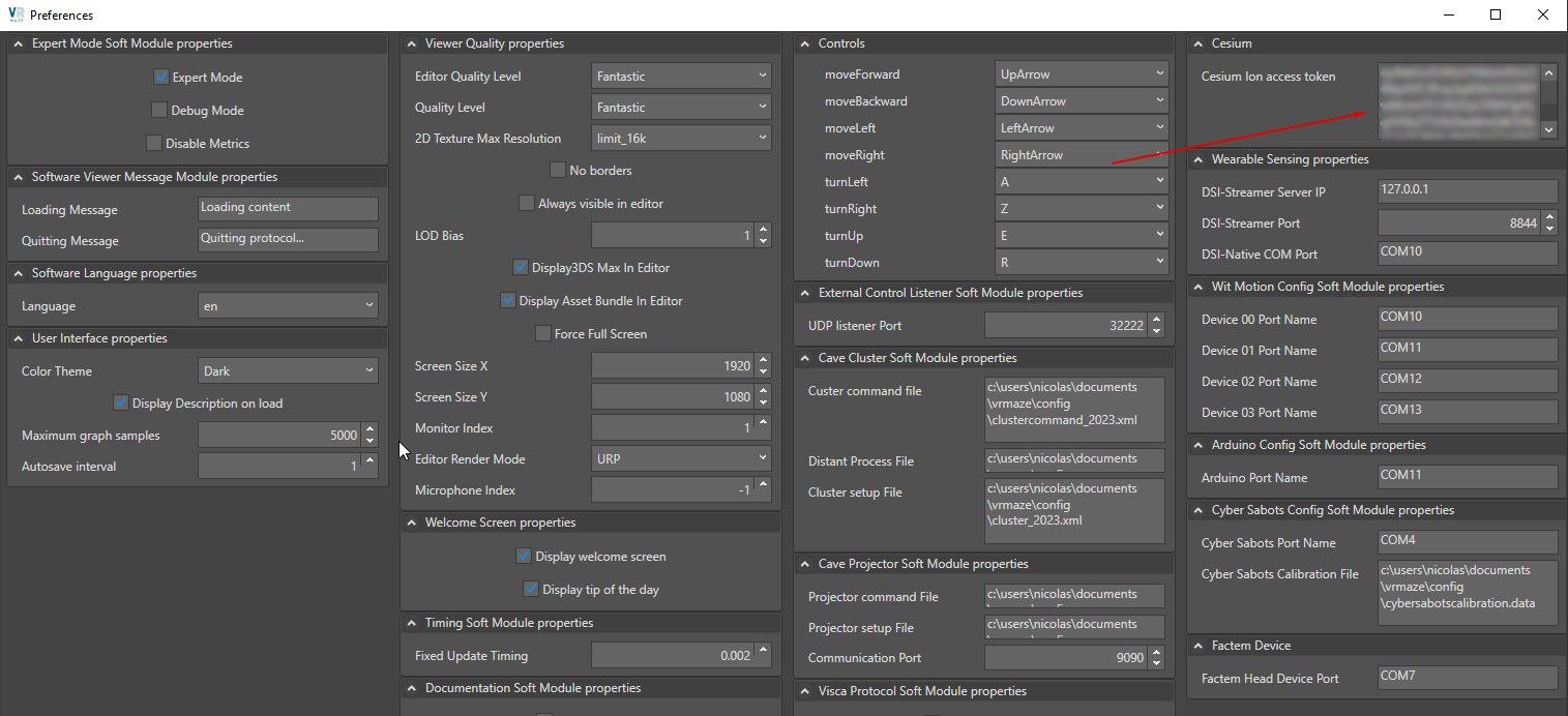
It is necessary, via the software preferences, to specify a Cesium access token to give access to MindDev. This token is not included in the protocol file, it is specific to the machine and is stored in the software preferences.
Cesium user account
The use of Cesium in MindDev requires an active Cesium user account.
Internet connection
The use of Cesium in MindDev requires an Internet connection during the execution of the pass.
Display in Design mode
The Cesium system is not displayed in Design mode. You should test its protocol to view Cesium data.
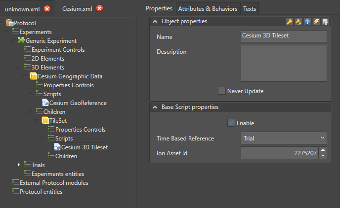
Cesium scripts
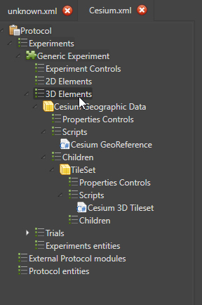
In version 2025 of MindDev, two scripts are available for managing data from Cesium:
- Cesium GeoReference (for specifying the geographical position)
- Cesium 3D TileSet (for specifying the data model to be used)
The use of these scripts is subject to a hierarchical structure:
- A first object of type GeomPoint which hosts the GeoReference script
- A second object, child of the first, also GeomPoint which hosts the 3D TileSet script
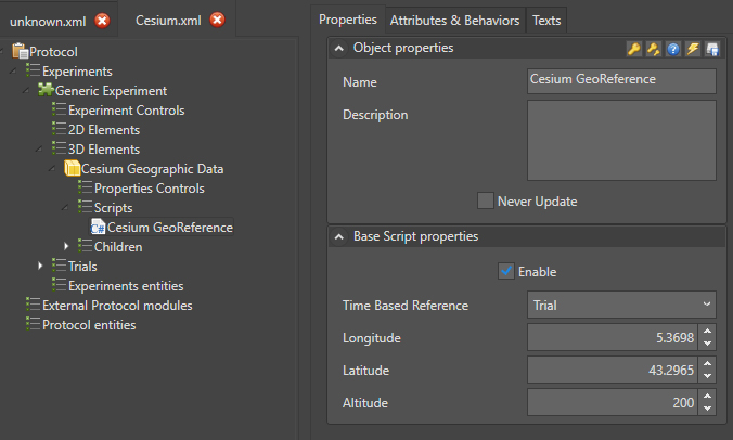
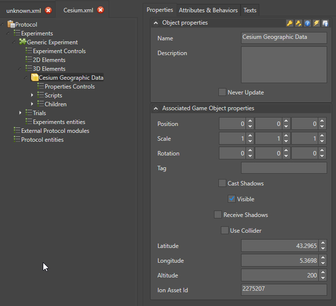
Cesium GeoReference
MindDev's Cesium GeoReference script is used to specify the camera's position on the globe. To do this, it has :
- Longitude
- Latitude
- Altitude
Cesium 3D TileSet
The Cesium 3D TileSet script allows you to specify which dataset should be used. To do this, you need to specify:
- The dataset identifier.
This identifier is directly available from the Cesium ION platform.
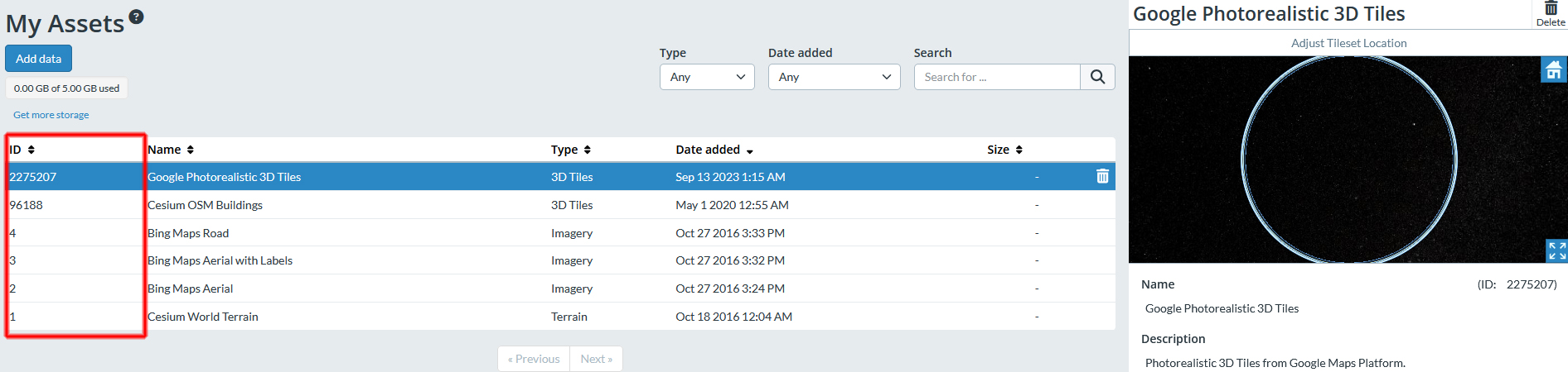
Cesium Asset Id
The Cesium asset Id is an integer value taken directly from Cesium ION.
Cesium object
The Cesium object is an object specially designed to control the parameters of a Cesium system. In fact, this object is just a simple structure for controlling the underlying objects and scripts. This object allows you to have under a single interface:
- Latitude
- Longitude
- Altitude
- Dataset ID
Cesium object
The Cesium object relies on scripts and child objects. Child entities should not be deleted.